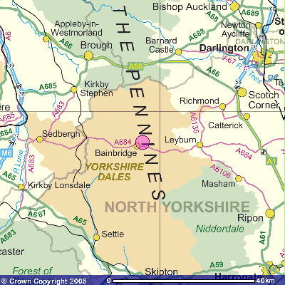
The pink circle indicates Askrigg's location - roughly half way between the A1 to the East and the M6 to the West. (Note: The main route through Wensleydale is the A684. Askrigg is not on the A684. We are on the road which runs to the north of the River Ure.)

Image produced from the Ordnance Survey Get-a-map
service.
Image reproduced with kind permission of Ordnance
Survey and
Ordnance Survey of Northern Ireland.